
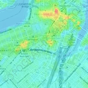
Bay Village Neighborhood Park topographic map
Interactive map
Click on the map to display elevation.
About this map
Name: Bay Village Neighborhood Park topographic map, elevation, terrain.
Average elevation: 36 ft
Minimum elevation: -20 ft
Maximum elevation: 161 ft
Other topographic maps
Click on a map to view its topography, its elevation and its terrain.
Mission Hill
USA > Massachusetts > Boston
Mission Hill, Avenue Louis Pasteur, Audubon Square, Fenway, Boston, Suffolk County, Massachusetts, 02120, USA
Average elevation: 56 ft
Beacon Hill
USA > Massachusetts > Boston
Beacon Hill, Boston, Suffolk County, Massachusetts, 02114, USA
Average elevation: 36 ft
Boston Public Garden
USA > Massachusetts > Boston
Boston Public Garden, Chinatown, Beacon Hill, Boston, Suffolk County, Massachusetts, USA
Average elevation: 36 ft