
Øyulvstad topographic map
Interactive map
Click on the map to display elevation.
About this map
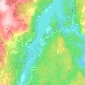
Name: Øyulvstad topographic map, elevation, terrain.
Location: Øyulvstad, Eikerapen, Åseral, Agder, 4544, Norwegen (58.51968 7.35344 58.55968 7.39344)
Average elevation: 1,289 ft
Minimum elevation: 761 ft
Maximum elevation: 2,287 ft