
Wüsting topographic map
Interactive map
Click on the map to display elevation.
About this map
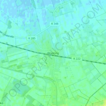
Name: Wüsting topographic map, elevation, terrain.
Average elevation: 13 ft
Minimum elevation: -7 ft
Maximum elevation: 43 ft
Other topographic maps
Click on a map to view its topography, its elevation and its terrain.
Nordenholz
Deutschland > Niedersachsen > Landkreis Oldenburg > Hude (Oldenburg)
Nordenholz, Hude (Oldenburg), Landkreis Oldenburg, Niedersachsen, 27798, Deutschland
Average elevation: 66 ft
Vielstedt
Deutschland > Niedersachsen > Landkreis Oldenburg > Hude (Oldenburg) > Vielstedt
Vielstedt, Hude (Oldenburg), Landkreis Oldenburg, Niedersachsen, 27798, Deutschland
Average elevation: 62 ft