
Thank you for supporting this site ❤️
Make a donation
Make a donation
Gear up for your next adventure:
As an Amazon Associate, this site earns from qualifying purchases at no extra cost to you.
Ma Cha topographic map
Click on the map to display elevation.
Thank you for supporting this site ❤️
Make a donation
Make a donation
Gear up for your next adventure:
As an Amazon Associate, this site earns from qualifying purchases at no extra cost to you.
About this map
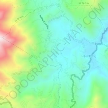
Name: Ma Cha topographic map, elevation, terrain.
Location: Ma Cha, Hàm Rồng, Sa Pa, Lao Cai province, 190000, Vietnam (22.34153 103.82903 22.38153 103.86903)
Average elevation: 4,849 ft
Minimum elevation: 4,029 ft
Maximum elevation: 6,808 ft
Thank you for supporting this site ❤️
Make a donation
Make a donation
Gear up for your next adventure:
As an Amazon Associate, this site earns from qualifying purchases at no extra cost to you.