
Habaraduwa topographic map
Interactive map
Click on the map to display elevation.
About this map
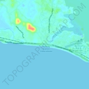
Name: Habaraduwa topographic map, elevation, terrain.
Location: Habaraduwa, Galle District, Southern Province, 80630, Sri Lanka (5.97378 80.28766 6.01378 80.32766)
Average elevation: 13 ft
Minimum elevation: -26 ft
Maximum elevation: 154 ft