
Undløse topographic map
Interactive map
Click on the map to display elevation.
About this map
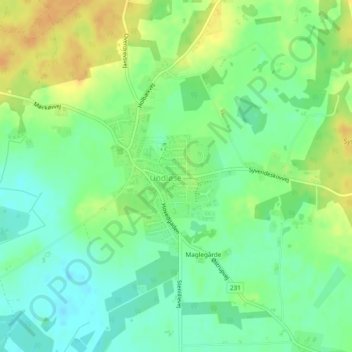
Name: Undløse topographic map, elevation, terrain.
Location: Undløse, Holbæk Municipality, Region Zealand, Denmark (55.59842 11.57982 55.60941 11.59806)
Average elevation: 118 ft
Minimum elevation: 72 ft
Maximum elevation: 174 ft