
La Rock topographic map
Interactive map
Click on the map to display elevation.
About this map
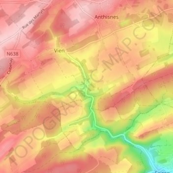
Name: La Rock topographic map, elevation, terrain.
Location: La Rock, Anthisnes, Liège, Wallonie, 4160, Belgique (50.44551 5.49524 50.48551 5.53524)
Average elevation: 761 ft
Minimum elevation: 377 ft
Maximum elevation: 961 ft