
Agolada topographic map
Click on the map to display elevation.
About this map
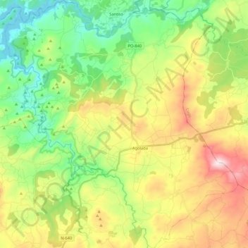
Name: Agolada topographic map, elevation, terrain.
Location: Agolada, O Deza, Pontevedra, Galicia, Spain (42.70001 -8.13338 42.85473 -7.93537)
Average elevation: 1,699 ft
Minimum elevation: 791 ft
Maximum elevation: 3,114 ft
Other topographic maps
Click on a map to view its topography, its elevation and its terrain.