
Agua Santa topographic map
Interactive map
Click on the map to display elevation.
About this map
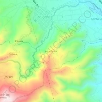
Name: Agua Santa topographic map, elevation, terrain.
Location: Agua Santa, Riobamba, Chimborazo, 060112, Ecuador (-1.72235 -78.69347 -1.68235 -78.65347)
Average elevation: 9,570 ft
Minimum elevation: 8,839 ft
Maximum elevation: 10,787 ft