
Chenois topographic map
Interactive map
Click on the map to display elevation.
About this map
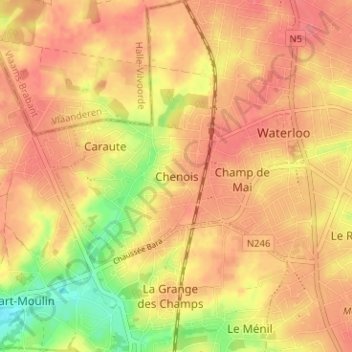
Name: Chenois topographic map, elevation, terrain.
Location: Chenois, Waterloo, Brabant wallon, Wallonie, 1410, Belgique (50.69044 4.35718 50.73044 4.39718)
Average elevation: 367 ft
Minimum elevation: 226 ft
Maximum elevation: 433 ft