
Llamera topographic map
Interactive map
Click on the map to display elevation.
About this map
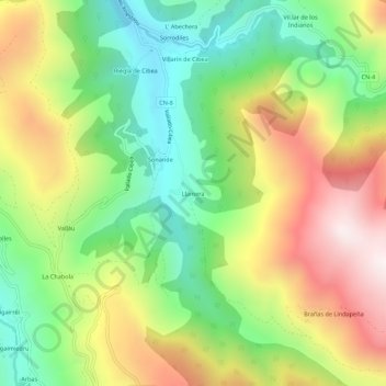
Name: Llamera topographic map, elevation, terrain.
Location: Llamera, Cangas del Narcea, Asturias, España (43.03325 -6.46529 43.07325 -6.42529)
Average elevation: 3,491 ft
Minimum elevation: 2,116 ft
Maximum elevation: 5,318 ft