
Rhewl topographic map
Interactive map
Click on the map to display elevation.
About this map
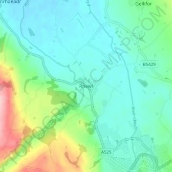
Name: Rhewl topographic map, elevation, terrain.
Location: Rhewl, Denbighshire, Wales, LL15 2TY, United Kingdom (53.11299 -3.35304 53.15299 -3.31304)
Average elevation: 249 ft
Minimum elevation: 112 ft
Maximum elevation: 682 ft