
Chilchota topographic map
Interactive map
Click on the map to display elevation.
About this map
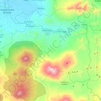
Name: Chilchota topographic map, elevation, terrain.
Location: Chilchota, Michoacán de Ocampo, México (19.71768 -102.21485 19.89314 -101.99410)
Average elevation: 7,028 ft
Minimum elevation: 5,558 ft
Maximum elevation: 10,240 ft