
Bélaye topographic map
Interactive map
Click on the map to display elevation.
About this map
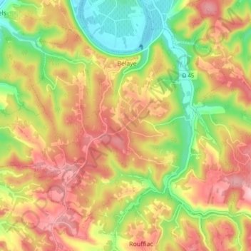
Name: Bélaye topographic map, elevation, terrain.
Average elevation: 623 ft
Minimum elevation: 279 ft
Maximum elevation: 932 ft
Other topographic maps
Click on a map to view its topography, its elevation and its terrain.
Les Granges
Frankrijk > Occitanië > Bélaye > Les Granges
Les Granges, Bélaye, Cahors, Lot, Occitanië, Metropolitaans Frankrijk, 46140, Frankrijk
Average elevation: 623 ft