
Wardin topographic map
Interactive map
Click on the map to display elevation.
About this map
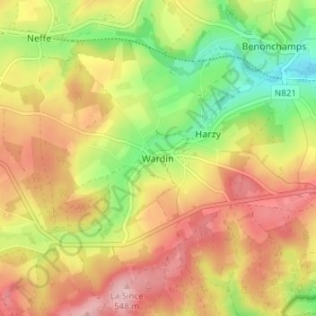
Name: Wardin topographic map, elevation, terrain.
Location: Wardin, Bastogne, Luxembourg, Wallonia, 6600, Belgium (49.97023 5.76579 50.01023 5.80579)
Average elevation: 1,575 ft
Minimum elevation: 1,286 ft
Maximum elevation: 1,827 ft