
Lavandeira topographic map
Interactive map
Click on the map to display elevation.
About this map
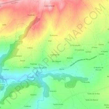
Name: Lavandeira topographic map, elevation, terrain.
Location: Lavandeira, Biville, Sarria, Lugo, Galiza, 27612, Espanha (42.75731 -7.52347 42.79731 -7.48347)
Average elevation: 2,087 ft
Minimum elevation: 1,670 ft
Maximum elevation: 2,615 ft
Other topographic maps
Click on a map to view its topography, its elevation and its terrain.
Nespereira
Espanha > Galiza > Sarria > Sarria
Nespereira, Sarria, Lugo, Galiza, 27613, Espanha
Average elevation: 2,047 ft