
Flugrath topographic map
Interactive map
Click on the map to display elevation.
About this map
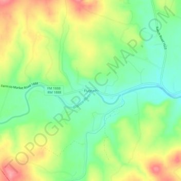
Name: Flugrath topographic map, elevation, terrain.
Location: Flugrath, Blanco County, Texas, United States of America (30.08299 -98.53975 30.12299 -98.49975)
Average elevation: 1,512 ft
Minimum elevation: 1,371 ft
Maximum elevation: 1,696 ft