
Holzheim topographic map
Interactive map
Click on the map to display elevation.
About this map
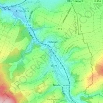
Name: Holzheim topographic map, elevation, terrain.
Location: Holzheim, Diez, Rhein-Lahn-Kreis, Rijnland-Palts, Duitsland (50.33157 7.99870 50.36892 8.07044)
Average elevation: 587 ft
Minimum elevation: 361 ft
Maximum elevation: 1,076 ft