
Uley topographic map
Interactive map
Click on the map to display elevation.
About this map
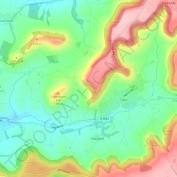
Name: Uley topographic map, elevation, terrain.
Location: Uley, Stroud, Gloucestershire, Angleterre, Royaume-Uni (51.66938 -2.33923 51.70097 -2.29332)
Average elevation: 459 ft
Minimum elevation: 220 ft
Maximum elevation: 823 ft
Other topographic maps
Click on a map to view its topography, its elevation and its terrain.
Dursley
Royaume-Uni > Angleterre > Gloucestershire > Stroud
Dursley, Stroud, Gloucestershire, Angleterre, Royaume-Uni
Average elevation: 384 ft