
抚松县 topographic map
Interactive map
Click on the map to display elevation.
About this map
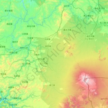
Name: 抚松县 topographic map, elevation, terrain.
Location: 抚松县, 白山市, Jilin, China (41.71124 127.02041 42.81914 128.08475)
Average elevation: 2,808 ft
Minimum elevation: 955 ft
Maximum elevation: 8,816 ft
Other topographic maps
Click on a map to view its topography, its elevation and its terrain.