
Zemu Glacier topographic map
Interactive map
Click on the map to display elevation.
About this map
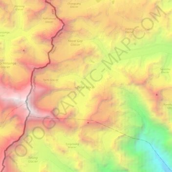
Name: Zemu Glacier topographic map, elevation, terrain.
Average elevation: 18,041 ft
Minimum elevation: 7,887 ft
Maximum elevation: 28,173 ft
Other topographic maps
Click on a map to view its topography, its elevation and its terrain.
South District
South District, Namchi District, Sikkim, 737139, India
Average elevation: 8,816 ft
North District
North District, North Sikkim District, Sikkim, India
Average elevation: 12,605 ft