
Black Mountain topographic map
Interactive map
Click on the map to display elevation.
About this map
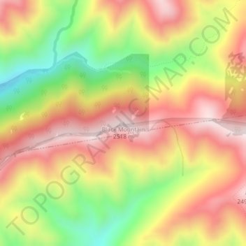
Name: Black Mountain topographic map, elevation, terrain.
Average elevation: 7,382 ft
Minimum elevation: 6,378 ft
Maximum elevation: 8,192 ft
Other topographic maps
Click on a map to view its topography, its elevation and its terrain.
Meridian Peak
United States > Utah > Salt Lake County > Salt Lake City
Meridian Peak, Salt Lake City, Salt Lake County, Utah, 84143, United States
Average elevation: 5,571 ft
Salt Lake City
United States > Utah > Salt Lake County > Salt Lake City
Salt Lake City, Salt Lake County, Utah, 84139, United States
Average elevation: 5,331 ft