
Brunegghorn topographic map
Interactive map
Click on the map to display elevation.
About this map
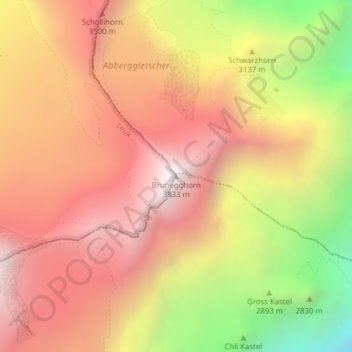
Name: Brunegghorn topographic map, elevation, terrain.
Location: Brunegghorn, Randa, Visp, Vallese, 3928, Svizzera (46.12570 7.74585 46.12580 7.74595)
Average elevation: 10,417 ft
Minimum elevation: 7,221 ft
Maximum elevation: 12,539 ft
Other topographic maps
Click on a map to view its topography, its elevation and its terrain.