
Martinville topographic map
Interactive map
Click on the map to display elevation.
About this map
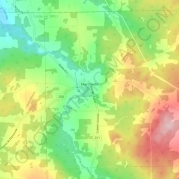
Name: Martinville topographic map, elevation, terrain.
Location: Martinville, Coaticook (MRC), Estrie, Québec, Canada (45.24593 -71.73865 45.30647 -71.64305)
Average elevation: 1,007 ft
Minimum elevation: 728 ft
Maximum elevation: 1,388 ft
Other topographic maps
Click on a map to view its topography, its elevation and its terrain.
Coaticook
Canada > Québec > Coaticook (MRC)
Coaticook, Coaticook (MRC), Estrie, Québec, Canada
Average elevation: 1,440 ft