
Spinney Hill Park topographic map
Interactive map
Click on the map to display elevation.
About this map
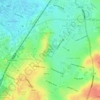
Name: Spinney Hill Park topographic map, elevation, terrain.
Average elevation: 240 ft
Minimum elevation: 180 ft
Maximum elevation: 331 ft
Other topographic maps
Click on a map to view its topography, its elevation and its terrain.
Grand Union Canal
United Kingdom > England > Leicester
Grand Union Canal, Leicester, City of Leicester, East Midlands, England, LE3 5EP, United Kingdom
Average elevation: 213 ft
Western Park
United Kingdom > England > Leicester
Western Park, New Parks, Leicester, City of Leicester, East Midlands, England, LE3 6HX, United Kingdom
Average elevation: 289 ft
Castle Hill Country Park
United Kingdom > England > Leicester
Castle Hill Country Park, Bradgate Heights, Leicester, City of Leicester, East Midlands, England, United Kingdom
Average elevation: 266 ft