Geolocate

Barbastro topographic map

Click on the map to display elevation.

About this map
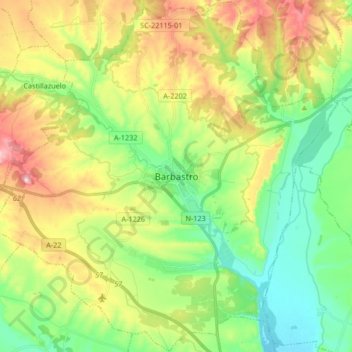
Name: Barbastro topographic map, elevation, terrain.

Location: Barbastro, Somontano de Barbastro, Huesca, Aragon, 22300, Spain (41.97537 0.03734 42.09806 0.20407)

Average elevation: 1,276 ft

Minimum elevation: 899 ft

Maximum elevation: 1,903 ft

Gear up for your next adventure:

🚁Photography Drones - Capture stunning aerial views of landforms and topography
🪶Paracord Bracelet - Survival bracelet with built‑in tools
🧥Waterproof Jacket for Hiking - Breathable and rugged rain jacket for outdoor excursions
📷Action Camera - Capture your outdoor adventures in HD
🔭Telescopic Hiking Pole - Adjustable pole for hiking stability

As an Amazon Associate, this site earns from qualifying purchases at no extra cost to you.