Geolocate

Poblete topographic map

Click on the map to display elevation.

About this map
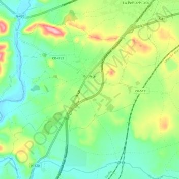
Name: Poblete topographic map, elevation, terrain.

Location: Poblete, Ciudad Real, Castile-La Mancha, 13195, Spain (38.89936 -4.05269 38.95922 -3.95287)

Average elevation: 2,044 ft

Minimum elevation: 1,867 ft

Maximum elevation: 2,398 ft

Other topographic maps

Click on a map to view its topography, its elevation and its terrain.

La Andada

Spain > Castile-La Mancha > Horcajo de Santiago

Average elevation: 2,497 ft

Gear up for your next adventure:

🍳Camping Cook Set - Complete cookware for outdoor meals
🌲Outdoor Survival Books - Best books on survival skills
🎒Trail Energy Bars - High‑calorie bars for hiking energy
🦶Carbon Trekking Poles - Reduce knee impact on steep descents with ultra-light poles
🗃️Trail First Aid Kit - Essential kit for outdoor injuries and emergencies

As an Amazon Associate, this site earns from qualifying purchases at no extra cost to you.