Geolocate

Apt topographic map

Click on the map to display elevation.

About this map
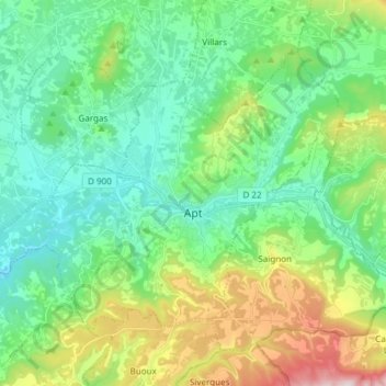
Name: Apt topographic map, elevation, terrain.

Location: Apt, Vaucluse, Provence-Alpes-Côte d'Azur, Metropolitan France, 84400, France (43.84177 5.30639 43.92090 5.45658)

Average elevation: 1,175 ft

Minimum elevation: 581 ft

Maximum elevation: 2,759 ft

Other topographic maps

Click on a map to view its topography, its elevation and its terrain.

Gear up for your next adventure:

🥾Women's Hiking Boots - Top-rated trail boots with ankle support and superior grip
🧣Merino Neck Gaiters - Multi-functional headwear for wind and sun protection
🖼️Topo Map Wall Art - Decorative topographic prints of famous peaks and regions
🔥Plasma Lighters - Windproof lighters that work in any weather condition
🩹Survival Bandages - High‑quality bandages for emergencies

As an Amazon Associate, this site earns from qualifying purchases at no extra cost to you.