
Ksar Chellala topographic map
Interactive map
Click on the map to display elevation.
About this map
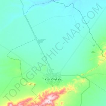
Name: Ksar Chellala topographic map, elevation, terrain.
Location: Ksar Chellala, daïra Ksar Chellala, Tiaret, 14011, Algérie (35.17785 2.23585 35.32188 2.40197)
Average elevation: 2,720 ft
Minimum elevation: 2,415 ft
Maximum elevation: 4,209 ft