
Serrania La Lindosa topographic map
Interactive map
Click on the map to display elevation.
About this map
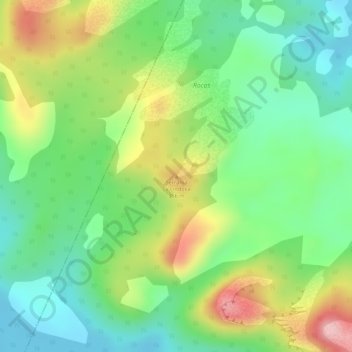
Name: Serrania La Lindosa topographic map, elevation, terrain.
Location: Serrania La Lindosa, Puerto Concordia, Ariari, Meta, Colombia (2.59818 -72.90320 2.59828 -72.90310)
Average elevation: 883 ft
Minimum elevation: 630 ft
Maximum elevation: 1,250 ft