Geolocate

Kanne topographic map

Click on the map to display elevation.

About this map

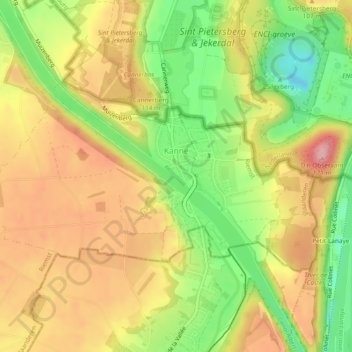
Name: Kanne topographic map, elevation, terrain.

Location: Kanne, Riemst, Tongeren, Limburg, Flanders, Belgium (50.80388 5.64083 50.82008 5.68816)

Average elevation: 285 ft

Minimum elevation: 33 ft

Maximum elevation: 502 ft

Gear up for your next adventure:

🩹Survival Bandages - High‑quality bandages for emergencies
🌡️Portable Weather Meter - Track weather conditions on the trail
🎒Hydration Pack - Hands‑free water reservoir for long hikes
🏕️Tent Footprint - Protect your tent base from wear
📖Nature Tracking Books - Learn to track wildlife and terrain

As an Amazon Associate, this site earns from qualifying purchases at no extra cost to you.