Geolocate

Winona topographic map

Click on the map to display elevation.

About this map

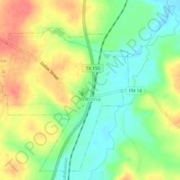
Name: Winona topographic map, elevation, terrain.

Location: Winona, Smith County, Texas, United States (32.47924 -95.19319 32.50477 -95.15967)

Average elevation: 377 ft

Minimum elevation: 285 ft

Maximum elevation: 479 ft

Smith County trails, hiking, mountain biking, running and outdoor activities

Gear up for your next adventure:

🌧️Backpack Rain Cover - Keep gear dry in wet weather
🧥Men's Rain Shells - Premium waterproof and breathable jackets for mountain weather
🎁Geography Themed Gifts - Unique gift ideas for map lovers and geography enthusiasts
📷Action Cameras - Rugged cameras to document your journeys across rugged terrain
👖Convertible Hiking Pants - Versatile zip-off pants for changing altitudes and temperatures

As an Amazon Associate, this site earns from qualifying purchases at no extra cost to you.