
陇西县 topographic map
Interactive map
Click on the map to display elevation.
About this map
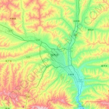
Name: 陇西县 topographic map, elevation, terrain.
Location: 陇西县, 定西市, 甘肃省, 中国 (34.84790 104.47902 35.16790 104.79902)
Average elevation: 6,463 ft
Minimum elevation: 5,213 ft
Maximum elevation: 8,553 ft
Other topographic maps
Click on a map to view its topography, its elevation and its terrain.