Geolocate

Distrito 2 topographic map

Click on the map to display elevation.

About this map

Name: Distrito 2 topographic map, elevation, terrain.

Location: Distrito 2, Albacete, Castile-La Mancha, Spain (38.97653 -1.88013 38.99638 -1.85652)

Average elevation: 2,251 ft

Minimum elevation: 2,218 ft

Maximum elevation: 2,293 ft

Other topographic maps

Click on a map to view its topography, its elevation and its terrain.
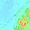
El Salobral

Spain > Castile-La Mancha > Albacete

Average elevation: 2,316 ft

Gear up for your next adventure:

👓Polarized Sunglasses - Outdoor sunglasses for glare reduction
🧥Waterproof Jacket for Hiking - Breathable and rugged rain jacket for outdoor excursions
👖Convertible Hiking Pants - Versatile zip-off pants for changing altitudes and temperatures
🧥Men's Rain Shells - Premium waterproof and breathable jackets for mountain weather
🏥Hiking First Aid Kits - Comprehensive medical kits for remote trail injuries

As an Amazon Associate, this site earns from qualifying purchases at no extra cost to you.