
Tarderia topographic map
Interactive map
Click on the map to display elevation.
About this map
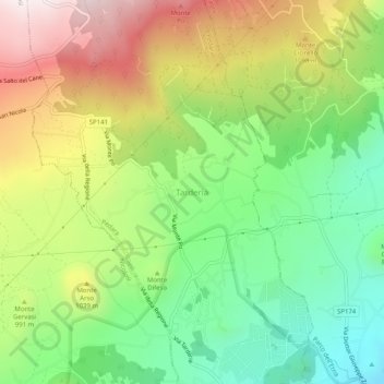
Name: Tarderia topographic map, elevation, terrain.
Location: Tarderia, Pedara, Catane, Sicile, 95030, Italie (37.63437 15.03148 37.67437 15.07148)
Average elevation: 3,031 ft
Minimum elevation: 1,985 ft
Maximum elevation: 4,462 ft