Geolocate

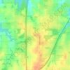
Shawnee topographic map

Click on the map to display elevation.

About this map
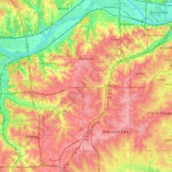
Name: Shawnee topographic map, elevation, terrain.

Location: Shawnee, Johnson County, Kansas, United States (38.97092 -94.90890 39.06161 -94.70509)

Average elevation: 935 ft

Minimum elevation: 719 ft

Maximum elevation: 1,102 ft

Johnson County trails, hiking, mountain biking, running and outdoor activities

Other topographic maps

Click on a map to view its topography, its elevation and its terrain.
Aubry

United States > Kansas > Johnson County

Average elevation: 1,066 ft

Frontier Park

United States > Kansas > Johnson County > Olathe

Average elevation: 1,027 ft

Kill Creek Park

United States > Kansas > Johnson County > De Soto

Average elevation: 902 ft

Olathe

United States > Kansas > Johnson County > Olathe

Average elevation: 991 ft

Lenexa

United States > Kansas > Johnson County > Lenexa

Average elevation: 951 ft

Prairie Highlands

United States > Kansas > Johnson County > Olathe

Average elevation: 1,030 ft

Gear up for your next adventure:

📡GPS Antenna Upgrade - Enhance GPS reception in remote terrain
🧺Microfiber Travel Towels - Compact and fast-drying towels for trail use
🪶Wildlife Field Guides - Learn animal tracking and species ID
⛺Backpacking Tents - Weight-optimized shelters for multi-day topographic surveys
🧣Hiking Neck Gaiter - Multi‑use neck protection for outdoor weather

As an Amazon Associate, this site earns from qualifying purchases at no extra cost to you.