
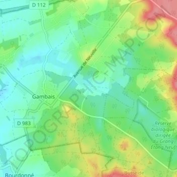
La Guérinoterie topographic map
Interactive map
Click on the map to display elevation.
About this map
Name: La Guérinoterie topographic map, elevation, terrain.
Average elevation: 413 ft
Minimum elevation: 328 ft
Maximum elevation: 597 ft
Other topographic maps
Click on a map to view its topography, its elevation and its terrain.
Le Boulay
France > Île-de-France > Yvelines > Gambais
Le Boulay, Gambais, Rambouillet, Yvelines, Île-de-France, France métropolitaine, 78950, France
Average elevation: 377 ft
Château de Neuville
France > Île-de-France > Yvelines > Gambais
Château de Neuville, Rue de Goupigny, Gambais, Rambouillet, Yvelines, Île-de-France, France métropolitaine, 78950, France
Average elevation: 387 ft