Geolocate

Fancy Gap topographic map

Click on the map to display elevation.

👉 Easily get elevation data in JSON, GeoTIFF and KML formats using Elevation API
Thank you for supporting this site ❤️
Make a donation

About this map

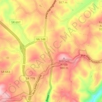
Name: Fancy Gap topographic map, elevation, terrain.

Location: Fancy Gap, Carroll County, Virginia, United States (36.64858 -80.72626 36.69722 -80.67420)

Average elevation: 2,838 ft

Minimum elevation: 2,182 ft

Maximum elevation: 3,261 ft

Carroll County trails, hiking, mountain biking, running and outdoor activities

Other topographic maps

Click on a map to view its topography, its elevation and its terrain.

Fancy Gap

United States > Virginia > Carroll County

Average elevation: 2,848 ft

Wolf Glade

United States > Virginia > Carroll County

Average elevation: 2,530 ft

Laurel Fork

United States > Virginia > Carroll County

Average elevation: 2,730 ft

Dugspur

United States > Virginia > Carroll County

Average elevation: 2,605 ft

Hickory Flat

United States > Virginia > Carroll County

Average elevation: 2,464 ft

Gear up for your next adventure:

🕶️Glacier Sunglasses - Side shields to protect eyes from high-altitude snow glare
🧭GPS Watch Accessories - Bands and chargers for GPS watches
🗃️Trail First Aid Kit - Essential kit for outdoor injuries and emergencies
📱Heavy-Duty Phone Cases - Drop-proof and waterproof protection for outdoor navigation
🗺️NatGeo Topo Maps - High-quality waterproof printed topographic maps of US Parks

As an Amazon Associate, this site earns from qualifying purchases at no extra cost to you.