
Lake Kitagata topographic map
Interactive map
Click on the map to display elevation.
About this map
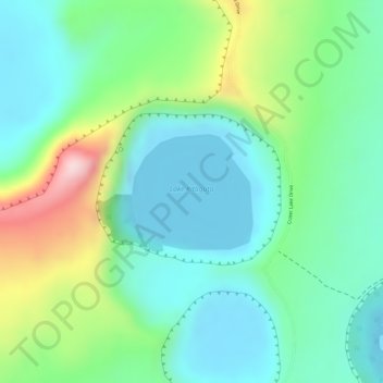
Name: Lake Kitagata topographic map, elevation, terrain.
Average elevation: 3,307 ft
Minimum elevation: 3,005 ft
Maximum elevation: 3,993 ft
Other topographic maps
Click on a map to view its topography, its elevation and its terrain.
Lake Nyamunuka
Lake Nyamunuka, Crater Lake Drive, Kikorongo, Kasese, Western Region, Ouganda
Average elevation: 3,123 ft