
Wakapuaka River topographic map
Interactive map
Click on the map to display elevation.
About this map
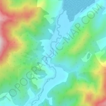
Name: Wakapuaka River topographic map, elevation, terrain.
Location: Wakapuaka River, Nelson, 7071, New Zealand (-41.20302 173.41336 -41.17166 173.42668)
Average elevation: 538 ft
Minimum elevation: -3 ft
Maximum elevation: 1,844 ft
Other topographic maps
Click on a map to view its topography, its elevation and its terrain.
Dew Lakes
New Zealand > Nelson > Nelson
Dew Lakes, Saddle Hill Route, Nelson, New Zealand
Average elevation: 2,625 ft
Whangamoa River
New Zealand > Nelson > Nelson
Whangamoa River, Nelson, New Zealand
Average elevation: 738 ft