Geolocate

Calabar topographic map

Click on the map to display elevation.

About this map

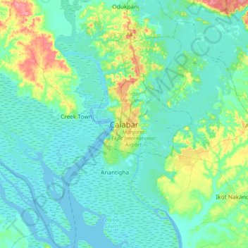
Name: Calabar topographic map, elevation, terrain.

Location: Calabar, Calabar Municipal, Cross River State, 540221, Nigeria (4.81960 8.17736 5.13960 8.49736)

Average elevation: 66 ft

Minimum elevation: -7 ft

Maximum elevation: 371 ft

Gear up for your next adventure:

🥄Camping Utensil Set - Lightweight utensils for outdoor meals
🪵Folding Camp Saw - Compact saw for wood and campsite work
🧯Emergency Survival Kit - All‑in‑one survival essentials for the backcountry
🧢Outdoor Hiking Hat - Sun protection hat for outdoor explorers
🧭Map Reading Tools - Tools and kits for map navigation

As an Amazon Associate, this site earns from qualifying purchases at no extra cost to you.