
la Serreta topographic map
Interactive map
Click on the map to display elevation.
About this map
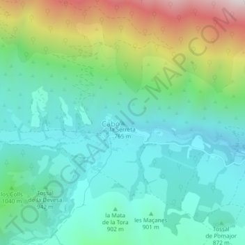
Name: la Serreta topographic map, elevation, terrain.
Location: la Serreta, Cabó, Alt Urgell, Lérida, Catalunha, Espanha (42.23919 1.24867 42.23929 1.24877)
Average elevation: 3,189 ft
Minimum elevation: 2,260 ft
Maximum elevation: 5,663 ft