
Xuancheng topographic map
Interactive map
Click on the map to display elevation.
About this map
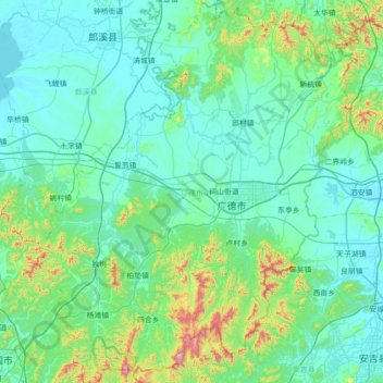
Name: Xuancheng topographic map, elevation, terrain.
Location: Xuancheng, 广德市, Anhui, Chine (30.59828 119.05345 31.20097 119.64532)
Average elevation: 367 ft
Minimum elevation: 10 ft
Maximum elevation: 2,648 ft