
Monte San Pietrangeli topographic map
Interactive map
Click on the map to display elevation.
About this map
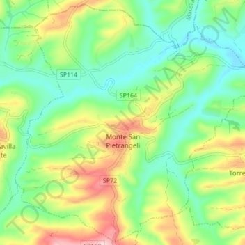
Name: Monte San Pietrangeli topographic map, elevation, terrain.
Location: Monte San Pietrangeli, Fermo, Marches, Italie (43.16889 13.54528 43.21718 13.61373)
Average elevation: 446 ft
Minimum elevation: 167 ft
Maximum elevation: 948 ft