
Maldegem topographic map
Interactive map
Click on the map to display elevation.
About this map
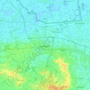
Name: Maldegem topographic map, elevation, terrain.
Location: Maldegem, Flandre orientale, Flandre, Belgique (51.14686 3.36048 51.27446 3.54493)
Average elevation: 23 ft
Minimum elevation: -7 ft
Maximum elevation: 102 ft