
Zümrütevler Mahallesi topographic map
Interactive map
Click on the map to display elevation.
About this map
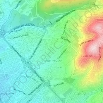
Name: Zümrütevler Mahallesi topographic map, elevation, terrain.
Average elevation: 423 ft
Minimum elevation: 89 ft
Maximum elevation: 1,250 ft
Other topographic maps
Click on a map to view its topography, its elevation and its terrain.
Fındıklı Mahallesi
Fındıklı Mahallesi, Maltepe, Istanbul, Marmara Region, 34854, Turkey
Average elevation: 358 ft
Bağlarbaşı Mahallesi
Bağlarbaşı Mahallesi, Maltepe, Istanbul, Marmara Region, Turkey
Average elevation: 85 ft