
Guasaganda topographic map
Interactive map
Click on the map to display elevation.
About this map
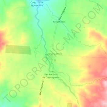
Name: Guasaganda topographic map, elevation, terrain.
Location: Guasaganda, La Maná, Cotopaxi, Ecuador (-0.82268 -79.18025 -0.78268 -79.14025)
Average elevation: 1,703 ft
Minimum elevation: 1,414 ft
Maximum elevation: 2,034 ft