
Matachewan Township topographic map
Interactive map
Click on the map to display elevation.
About this map
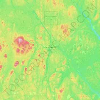
Name: Matachewan Township topographic map, elevation, terrain.
Average elevation: 1,129 ft
Minimum elevation: 853 ft
Maximum elevation: 1,870 ft
Other topographic maps
Click on a map to view its topography, its elevation and its terrain.
Kirkland Lake
Canada > Ontario > Timiskaming District
Kirkland Lake, Timiskaming District, Northeastern Ontario, Ontario, Canada
Average elevation: 1,089 ft
Wolf Creek
Canada > Ontario > Timiskaming District > Unorganized West Timiskaming
Wolf Creek, Unorganized West Timiskaming, Timiskaming District, Northeastern Ontario, Ontario, Canada
Average elevation: 1,073 ft