
江古田2 topographic map
Interactive map
Click on the map to display elevation.
About this map
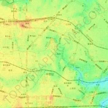
Name: 江古田2 topographic map, elevation, terrain.
Location: 江古田2, Tokyo, Nakano, 165-0022, Japan (35.70553 139.64629 35.74553 139.68629)
Average elevation: 131 ft
Minimum elevation: 62 ft
Maximum elevation: 171 ft