
San Luis Village topographic map
Interactive map
Click on the map to display elevation.
About this map
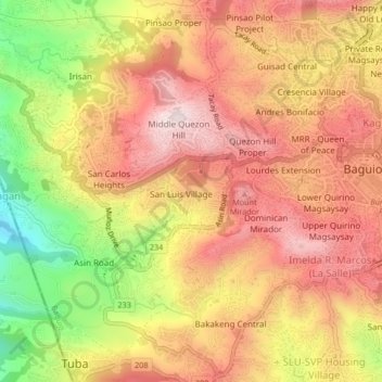
Name: San Luis Village topographic map, elevation, terrain.
Location: San Luis Village, Baguio, Benguet, 2600, Philippines (16.38960 120.55461 16.42960 120.59461)
Average elevation: 4,521 ft
Minimum elevation: 3,507 ft
Maximum elevation: 5,194 ft